• BEST VIEWED WITH FIREFOX

  • Partner: PROTECT YOUR WATERS
  • Go To: FLY FISHING IN YELLOWSTONE NATIONAL PARK
  • Go To: THE FLIES OF YELLOWSTONE
  • Friday, May 7, 2010

    Getting Crowded

    ONE SMALL STEP
    Integrated Locations
    -------
    .. With a few, (well informed,) clicks of the mouse we've combined the old maps with the new map.
    .. This is not our forte and, for the moment, all data points are being plotted on the master map. Eventually there will be river segment maps that can be viewed individually.
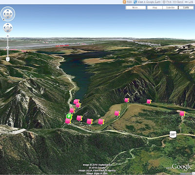
    .. With the Google Maps interface there is now a broader range of manipulations available for the user. These maps may now be viewed in Google Earth, and provide for RSS feeds, printing, email, and linking.
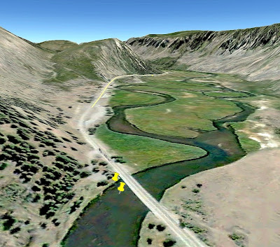
    .. When viewed in Google Earth it is also possible to view a 3-D image of the terrain and glean some idea of what to expect when exploring new locations. This view also shows the relationship of the various locales should you be planning a "run-n-gun" day or two.
    .. As you peruse the maps you will frequently note the redundancy of information and photos. This is an artifact of importing the complete data set from the Platial Maps.
    .. Also, the place markers are in the process of being changed and will eventually be replaced with markers that make some sort of visual sense. We'll winnow it down as time progresses.
    .. The integrated map can be found HERE.
    -------
    .
    .

    Wednesday, May 5, 2010

    Recovered - AHA !

    A TECH-SAVVY SAVE
    Thanks To Kenneth Sperry
    fly fishing reporter to the rescue

    -------
    .. For those waiting for our snails paced re-mapping project, there is now a web location of the old map data base.
    .. The website FLY FISHING REPORTER has recovered the original data base. Thanks again to Kenneth Sperry, a fisher far more tech savvy than us.
    .. We left the data base public and have been working with the KLM & KMZ files but couldn't get them into Google Maps in a public fashion.Those with greater skill than us have accomplished the task - HUZZAH !!
    .. For the old map set click HERE. Muchas Gracias!
    -------
    .

    Sunday, March 14, 2010

    Phase One

    COLLECT THE DATA
    The Old & The New
    -------
    .. With the implosion of Platial, we're moving our maps to Google, (go figure.) The data sets will be up in a couple of weeks. There are some new photos and access directions that need to be added to the old data set.
    .. Then, new locations. No secrets but current conditions and prospects. A few of the neighbors will also be adding locations and tips. You can see the start, (from last May when Platial started to crap out,) HERE.
    .. Stay tuned. . . .

    Friday, January 8, 2010

    Trouble In Paradise

    WE'VE BEEN HAVING GLITCHES
    New Maps On The Way
    ------
    .. The maps from Platial have been slow to load on this page & are under review and being replaced with an integrated map; complete with images and interactive features.
    .. We apologize for the inconvenience. The offending code and images have been removed for the moment. Winter will give us the time to get most of this page back in order.
    .. For now please click HERE to go to our map page at Platial. There have been nearly 200,000 views of the maps in the last two years. More and better are on the way.
    -------

    Wednesday, May 7, 2008

    Mapping Continues

    SHORT BUT SWEET

    .. We've added some places on the Gallatin River - (Grayling Creek,) Gibbon River, and the Madison River outside of Yellowstone National Park.
    .. The Grayling Creek locations are on the Gallatin River map because of their proximity and access points. They will also be included on the Madison River map.
    .. The general map has been skewed by a visitor who place a location somewhere between Shafer and Hannahsville in West Virginia. It looks rugged and "Trouty" but it's not Yellowstone. As soon as we figure out how to remove it the base map will be back to an easily navigable size.
    .. So far there have been over 1,000,000 visits to the maps. This is growing by somewhere between 200 and 500 per day at the present time.
    .. For access to all maps individually go to "YELLOWSTONER'S MAPS."

    Friday, March 14, 2008

    Moving Along - Slowly

    1] .. We are currently constructing this map page for the major river segments in and around Yellowstone National Park. The progress is slow but steady. There are now 9 maps with over 150 places. The maps have been viewed over 20,000 times in just 3 months. Pictures have been added as they become available.
    2] .. The maps are designed with full permission to copy them, or make them your own on PLATIAL.COM; you can read about these and other maps being compiled on the Platial Blog.
    3] .. To see all of the places on a single combined map go to Yellowstoner's Platial Places.